role: product designer
overview
Helping tourists rediscover Dublin safely, and on their own
Visit Dublin is the city's official tourism platform. It launched in the wake of the COVID-19 pandemic with a clear job to do: give visitors a trustworthy place to plan and book their trips, and put Irish cafes, restaurants, hotels, hostels and other local hospitality business in front of as many people as possible.
I designed Routes & Trails, a new feature layered onto the site's existing interactive map. It gives visitors self-guided walking trails that connect Dublin's historical landmarks, with audio content at each stop so people can learn the city's stories on their own and it surfaces nearby local businesses as they walk. I owned the feature end to end, from the initial insight through to the shipped design.
the challenge
A proud, walkable city at a moment when groups felt unsafe
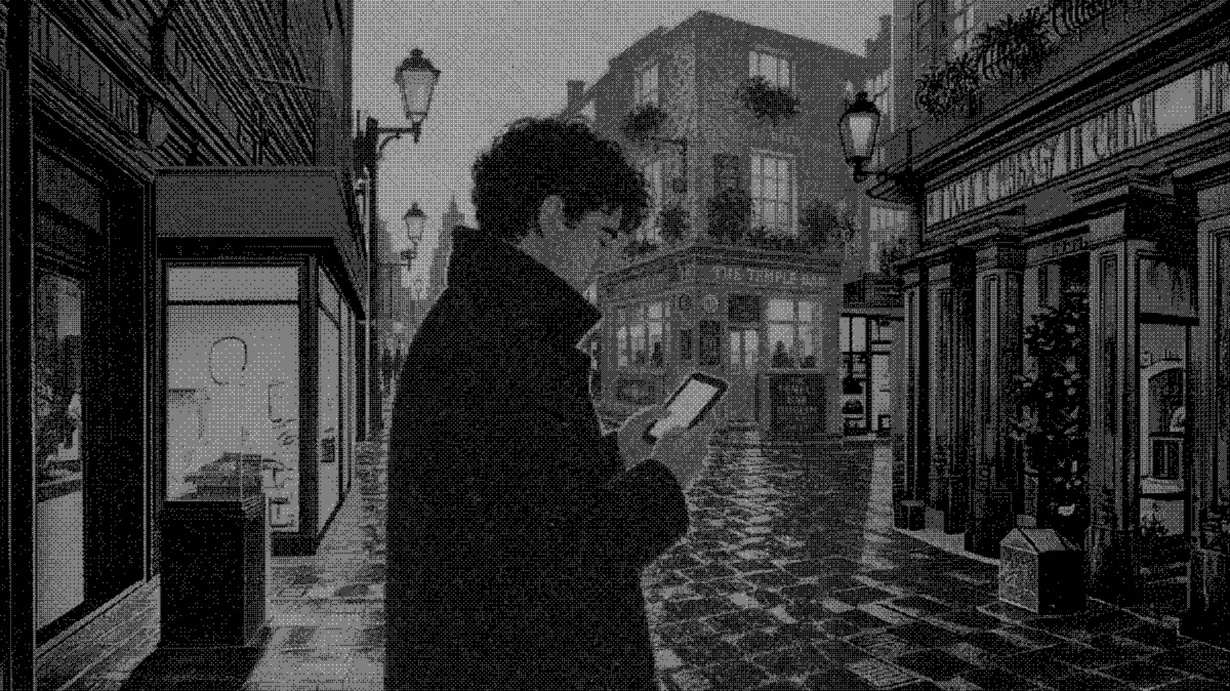
Dublin's history is written into its streets. Its landmarks and small lanes carry real meaning for Irish citizens, who take pride in showing that heritage to visitors, and guided walking tours have always been one of the most popular things a tourist can do here.
But in the first months after the pandemic, that model broke. Visitors were reluctant to gather in the large groups that traditional walking tours depend on. The demand to explore Dublin on foot was still there; the safe way to satisfy it was not. That created a design opportunity with a few distinct needs to balance:
the process
From a timely idea to a map layer that earns its place
Framing the idea
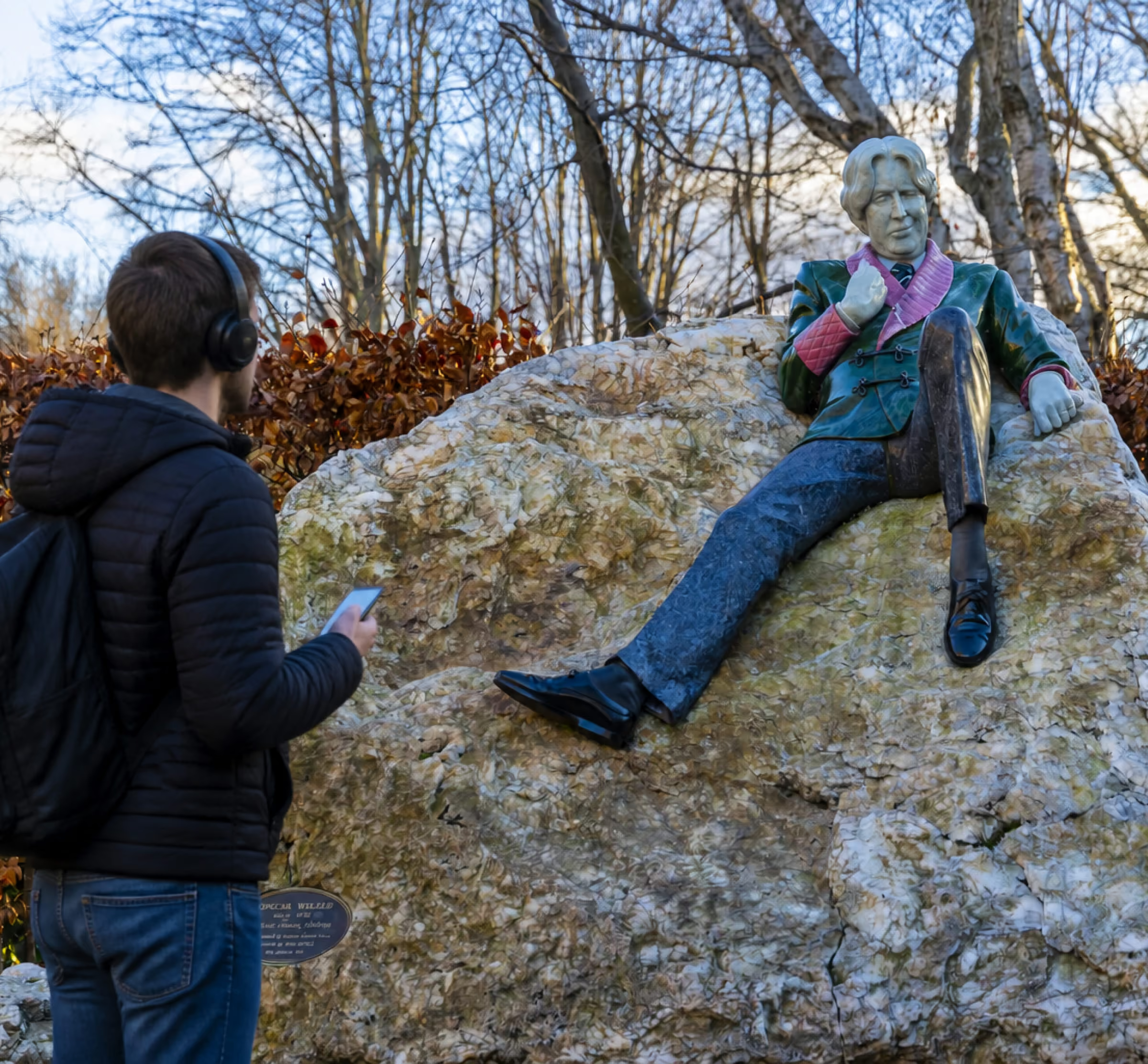
When I took over the project from the previous designer who originally desigend Visit Dublin, I spent some time diggesting the original briefing and reading the documentation of the discovery process. I then found about a project called Talking Statues. The project also belonged to Fáilte Ireland, the same organisation that runs Visit Dublin and it was collection of sound bites made to portray statues around Dublin. The seed for the idea was there, it just needed the right execution.
The appetite for walking tours hadn't disappeared, only the group format had. If I could use the sound bites from Talking Status and turn them into a guided tour for a person to do alone, with the map as their guide and audio as their storyteller, I could give visitors the experience they wanted, safely, while serving Visit Dublin's commercial goal at the same time. Rather than build a new destination, I proposed adding trails as a new layer on the map users already trusted.
Designing on top of an existing system
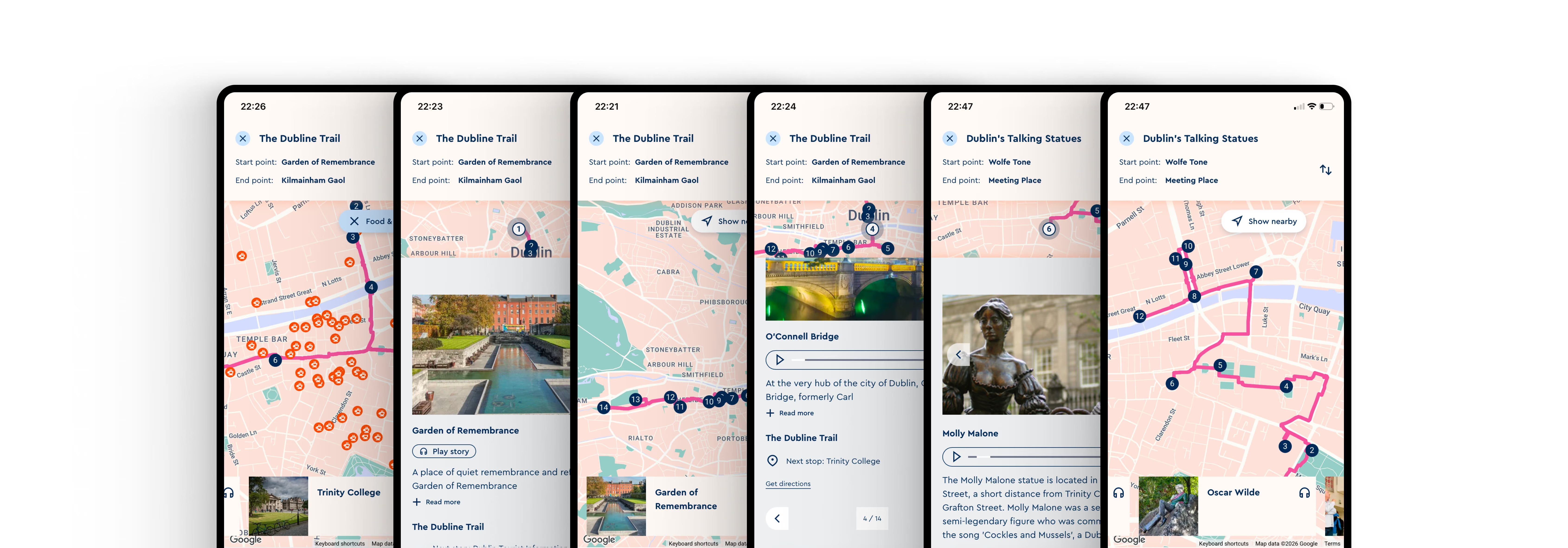
Because the map and its component library already existed, my job was to extend them coherently, not reinvent them. I reused the established map, pins, cards, tags and controls, and introduced only the new pieces the feature genuinely needed: a trail line connecting stops, a trail header (name, start and end points, stop count), a stop-by-stop list, a landmark detail card with audio, and a “show nearby” filter. Keeping the feature inside the existing design language is what let it feel like a natural part of the site from day one.
Key design decisions
The value wasn’t just the artefacts, it was alignment. By the end, stakeholders and the design team held the same definition of success, which made every later decision faster to make and easy to defend.
the solution
A walking companion built into the map
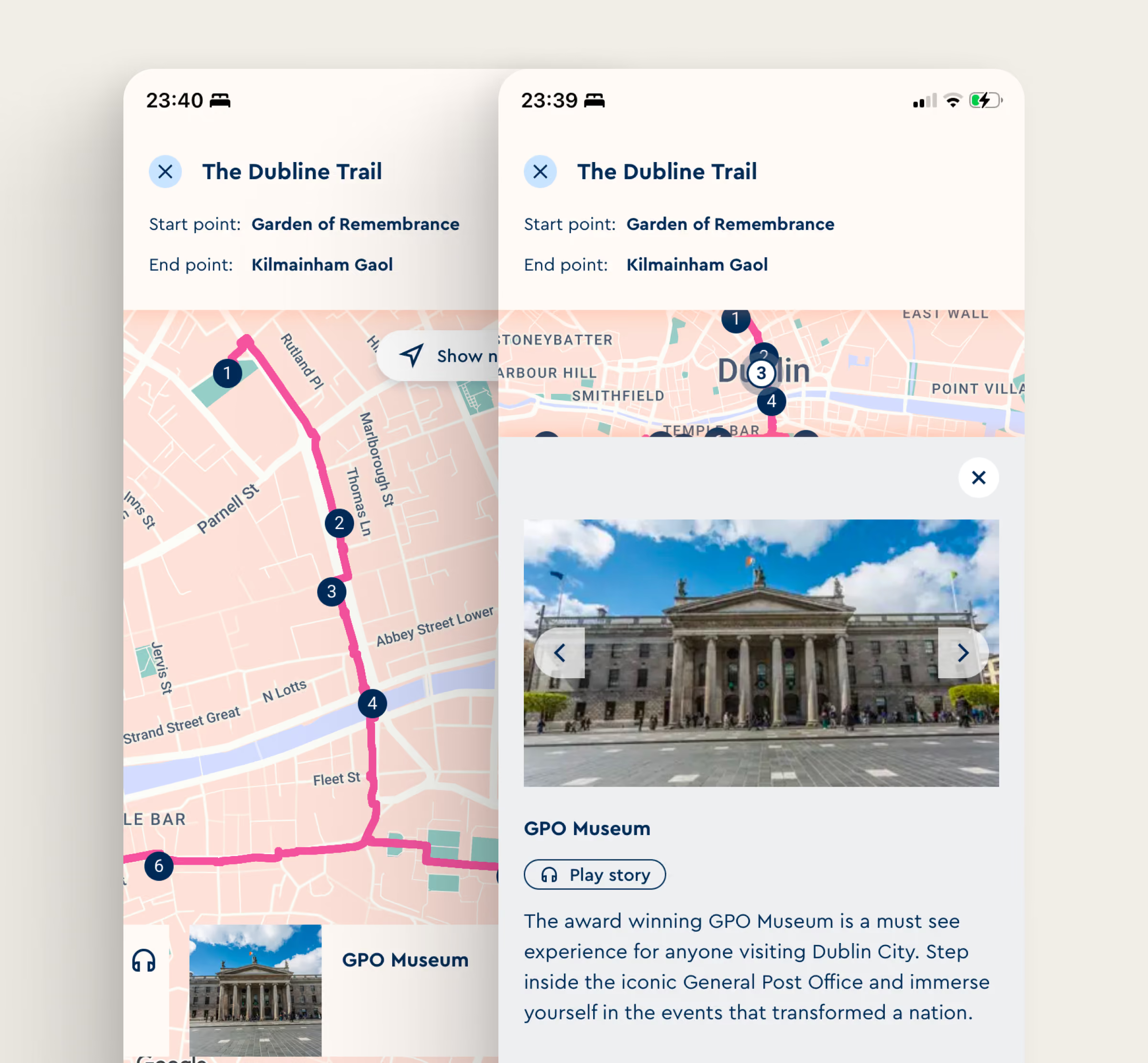
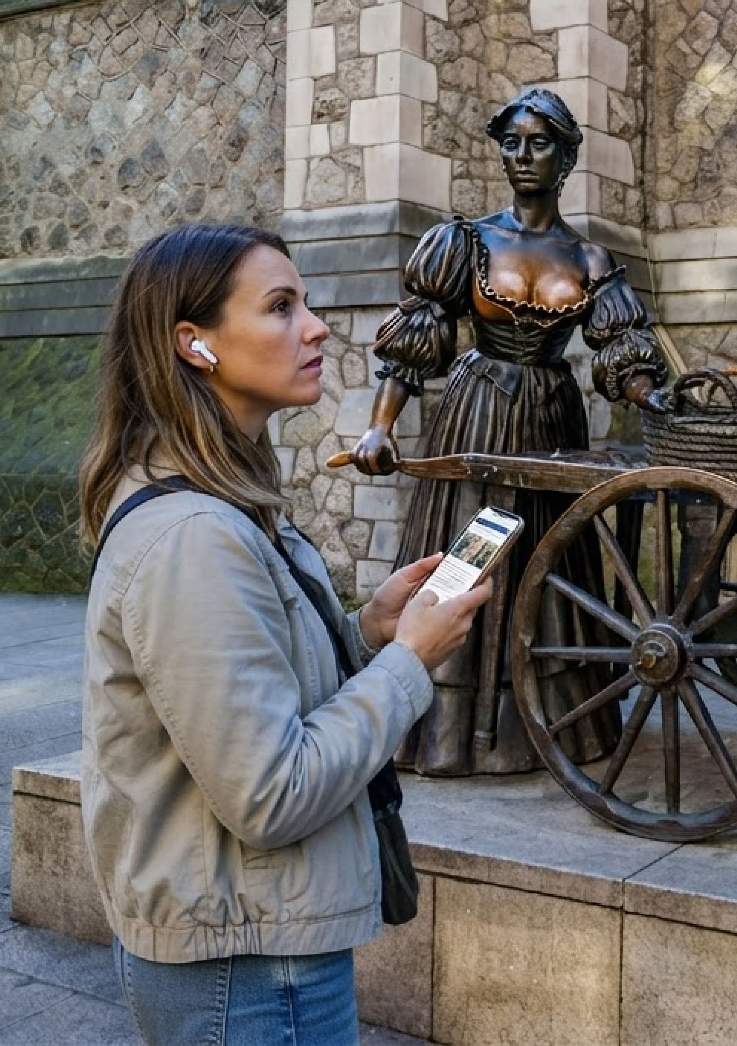
Routes & Trails turns the Visit Dublin map into a self-guided tour guide. A visitor picks a trail, for example The Dubline, or a themed walk like the Easter Rising walk and the map plots the full route across the city, pinning each landmark in sequence. A side panel lists every stop, so the walk is easy to scan and follow.
At each landmark: a stop that tells a story
Selecting a landmark opens a detail card with a photo, a short piece of heritage writing, and audio content. A visitor standing at the GPO can read and hear how it sat at the centre of the 1916 Easter Rising. The card also points to the next stop so one walk can lead naturally into another.
Along the way: local Dublin, one tap away
A “Show nearby” filter lets visitors reveal what's around them as they walk (cafes, restaurants, places to stay) shown as category tags they can toggle. This is where the feature quietly does Visit Dublin's most important job: as people follow a historical trail, the platform keeps putting local Irish businesses in front of them for a short stop, turning a heritage walk into visibility for the city's enterprises.
More than one way to walk the city
Trails are curated and varied so visitors can choose a walk that matches their time and interest. Whichever they pick, the experience is consistent: a clear route, a story at every stop, and local business never far away.
Consistent with the platform
Every element, pins, cards, tags, buttons, pagination, the current-location marker comes from the existing Visit Dublin design system. Nothing about Routes & Trails asks the user to relearn the map. That consistency was a deliberate design goal: the feature had to feel like it had always been there.
the impact
A safe, self-guided way to experience Dublin that still sells the city
Routes & Trails shipped as part of the Visit Dublin website. Qualitatively, it delivered against each of the needs the challenge set out: